PocketLAI is an Android mobile application allowing the estimation of leaf area index (LAI) using any modern Android smartphone. The patented logic is based on image data acquired from the device camera while user rotates the phone along its elongation axis in front of the canopy. Stored frames are processed in real-time and image statistics are then used in radiation-tranfering models to compute the output LAI estimate.
PocketLAI is ony available for Android.
No iPhone version is planned in short times.
Data is stored within the user device. LAI values can be browsed in the Table View where they are grouped basing on the parcels database created by the user while taking the measurements.
For each measurement spot GPS coordinates can be eventually recorded.
A minimum default number of measurement replicas are suggested by PocketLAI to improve LAI reading accuracy. The Settings View allows the the user to change this value to either take a more qualitative approach or focus on quality of results.
An optional outlier filter based on Grubbs’ Test can be applied to replica values to automatically discard bad readings before computing the average on the measurement set.
All LAI values can be exported in several formats for office post-processing activities. Among the export formats the Shape File format (.SHP) allows for easy plotting on maps.
PocketLAI does not require any data connection beside in the activation step. All Data never leaves the device unless due to user actions. Cassandra Tech never touches, monitors or stores any information the user creates with the app. No cloud storage/backup is provided for LAI data whose backup is entirely in user responsibilities.
PocketLAI was tested with success on a variety of full-field crops as well as trees species.
Its measurements have been compared with those from LAI-metering phisical devices (e.g., LAI2000, ceptometers) and the results have been published on several peer-reviewd international scientific journals.
Such outcomes support the reliability and accuracy of PocketLAI in estimating leaf area index (LAI) when the required conditions are met.


Usage
FAQ
PocketLAI FAQ ENG
Once you have installed and ad started the App, enter 'Data' page. Here press the 'Request activation code' button': you will be led to a web page whe you have to provide:
- your name
- your mail address
- you phone model
Please complete the request form by cheking the "I am not a robot" flag and press the [SUBMIT] button.
Before leaving the page, wait for the submission confirmation.
Our Staff will soon send you an activation code by mail. Once you get it, enter the App and copy it inside the field named 'Insert unlocking code', available in the 'Data' page of PocketLAI.
Restart the app to unlock all features.
TAKING THE PICTURES
The camera should be held horizontally at the level of soil (water for rice). Please refer to this video to get what we mean: https://youtu.be/qQPfzAxsGSs
The distance between the plants and the phone lens should be 10 cm but for very thick canopy this distance can be lowered to a few centimeters. The less the portrayed canopy is disturbed by the action of taking the picture, the better is for the result. While opening the canopy the suggestion is to gently bend some plants to one side using the free hand, then take the picture of the other undisturbed plants with the phone. One of the key points to good measurements is including in the pictures just the plants and the sky. So beware of plants, building and colleagues.
Also avoid including the sun in the pictures.
WEATHER AND TIMING
PocketLAI has no restrictions on operation timings in the day provided the sky is already/still blue. PocketLAI cannot be used with pink/orange/red sunsets/dawns.
Also clouds do not cause any problems unless they are very dark thunderstorm clouds. Translucent cirrus clouds or dense white/gray clouds are handled by the processing algorithm.
AVERAGING
PocketLAI offers the chance of performing averaging over a number of pictures: we strongly suggest to use this feature (should be enabled by default). For research purposes do not take less than 4 (four) repetitions for each measure as such repeated measure are the key to best accuracy. One single measure could be accidentally taken with a leaf right in front of the lens resulting in a large overestimation of LAI.
PocketLAI also embeds Grubb's Test that assesses the measure and ignores ONE eventual outlier in computing the average. Enable this feature if you plan to take 7 or more pictures per measure.
Pictures included in a single measurement set should be taken around one physical location in the field, by moving around the selected "center" of not more than 1 meter in radius. While doing this, we suggest also changing the azimuth of the picture: the direction towards which the camera is pointed. While the first picture can be taken keeping the sun right behind one's shoulders, the other pictures should explore the directions around the first one. Do not extend the explored angle more than 90° to the left and to the right of the first picture otherwise there will be a risk of including the sun in the pictures.
EXPLORING VARIABILITY
To achieve a good understanding of field variability, more than one set of measurement should be taken.
Planning how to optimize this task is beyond the purpose of this guide but NDVI or NDRE free satellite maps (10x10m pixel size) dating no more than 4-6 days can be a good source of hints about where to take further measurement sets.
Reference scientific papers
Confalonieri, R., Foi, M., Casa, R. et al., 2013. Development of an app for estimating leaf area index using a smartphone. Trueness and precision determination and comparison with other indirect methods. Computers and Electronics in Agriculture, 96, 67-74.
Francone, C., Pagani, V., Foi, M., Cappelli, G., Confalonieri, R., 2014. Comparison of leaf area index estimates by ceptometer and PocketLAI smart app in canopies with different structures. Field Crops Research, 155, 38-41.
Orlando, F., Movedi, E., Paleari, L., Gilardelli, C., Foi, M., Dell’Oro, M., Confalonieri, R., 2015. Estimating leaf area index in tree species using the PocketLAI smart app. Applied Vegetation Science, 18, 716-723.
Campos-Taberner, M., García-Haro, J., Confalonieri, R., Martínez, B., Moreno, Á., Sánchez-Ruiz, S., Gilabert, M.A., Camacho, F., Boschetti, M., Busetto, L., 2016. Multitemporal monitoring of plant area index in the Valencia rice district with PocketLAI. Remote Sensing, 8, 202-17.
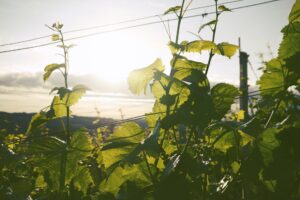
Orlando, F., Movedi, E., Coduto, D., Parisi, S., Brancadoro, L., Pagani, V., Guarneri, T., Confalonieri, R., 2016. Estimating LAI in vineyard using the PocketLAI smart-app. Sensors, 16, 2004.
 PocketSPRAY